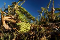

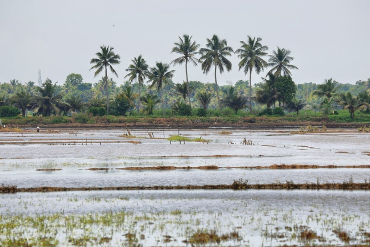
Cyclone Arnab crossed the coast of Andhra Pradesh in south-eastern India in the early hours of 28 October 2026 as a very severe cyclonic storm, with maximum sustained winds of 125 to 135 km/h gusting to 150 km/h, according to the India Meteorological Department (IMD). It came ashore near Narsapur and Kakinada, in an area where the monsoon-season rice crop is close to ripening. From 1996 to 2025, cyclones of cyclonic-storm strength or above crossed the state's coast in October to December in 9 of 30 years, and only three of them were very severe or stronger, according to a Wikifarmer analysis of IMD records.
Arnab made landfall near Narsapur with sustained winds of 125 to 135 km/h
In IMD's National Bulletin No. 25, issued at 12:00 India time on 28 October, the cyclone crossed the Andhra Pradesh and Yanam coasts between Bapatla and Visakhapatnam, southwest of Yanam, near 16.45°N 81.9°E. That is about 20 km east-northeast of Narsapur and 60 km southwest of Kakinada, and the crossing took place between 02:00 and 08:00 India time. The landfall process was complete by 08:00, with the centre fully over land, and by 08:30 Arnab had weakened into a severe cyclonic storm. IMD says it is very likely to move north-northwestwards over the next 48 hours and weaken gradually, into a cyclonic storm within six hours and a deep depression in the six hours after that. In National Bulletin No. 32, issued at 12:30 India time on 29 October, the system was a depression at 08:30 that day, the remnant of Arnab, over south Chhattisgarh and adjoining south Odisha near 19.4°N 81.9°E, and IMD says it is very likely to move nearly northwards and weaken into a well-marked low-pressure area.
More than 210 mm of rain was recorded at places on the coast
In the 24 hours to 08:30 on 28 October, IMD recorded extremely heavy rain of more than 210 mm at places over coastal Andhra Pradesh and Yanam and over Odisha, according to its press release of the same day. The highest coastal Andhra Pradesh value was 260 mm at Garividi in Vizianagaram district, north of the landfall point, and the highest in Odisha was 250 mm in Gajapati district. For 28 October, National Bulletin No. 25 says heavy to very heavy rain (70 to 200 mm) at a few places and extremely heavy rain (more than 210 mm) at isolated places is very likely over Andhra Pradesh, and heavy rain at isolated places over north coastal Andhra Pradesh on 29 October.
IMD warned of major damage to crops and orchards
For coastal Andhra Pradesh on 28 October, the expected impacts in National Bulletin No. 25 include, for agriculture, major damage to standing crops, plantations and orchards, falling of green coconuts and tearing of palm fronds, major damage to banana, papaya and drumstick trees, blowing down of bushy trees like mango, and major damage to coastal crops. These are the impacts IMD associates with the storm's intensity, not a damage count. In the agromet advice of its press release, IMD tells coastal Andhra Pradesh to ensure adequate drainage in standing crops, avoid intercultural operations in wet soil and postpone rabi sowing in the Southern Zone until the rain recedes.
Press reports put the state's preliminary estimate at 224,489 hectares of crops
According to the news site TeluguPeople, Andhra Pradesh Agriculture Minister Kinjarapu Atchannaidu presented preliminary assessments on 29 October showing 224,489 hectares of crops submerged or damaged in 14 districts, and The Pioneer newspaper reports the same figure in the minister's request to the central government. Of these, according to both outlets, 211,726 hectares are agricultural crops, with paddy accounting for about 209,460 hectares, and TeluguPeople reports a further 12,763 hectares or so of horticultural crops. The Pioneer gives the largest areas in West Godavari (76,176 hectares), Konaseema (44,232) and Kakinada (42,222) without saying which office produced the district figures, and it reports that the state government has confirmed five deaths.
The estimate is about 2.8 times the figures in the letter that Chief Minister N. Chandrababu Naidu sent to India's Union Home Minister on 28 October, which, according to Deccan Chronicle and Telugu360, cited about 70,900 hectares of paddy and 10,450 hectares of horticultural crops. Both estimates are described as preliminary, and Wikifarmer did not find an official state document by 29 October, so the figures are given as the press reported them.
Kharif rice is at the end of its reproductive phase
In GEOGLAM's crop calendar for southern India, kharif (monsoon-season) rice is in its vegetative to reproductive phase from 15 September to 31 October, and ripening and rice harvesting run from 1 November to 14 December. On that calendar, Arnab reached the coast four days before the ripening period begins, and GEOGLAM places the end of the harvest season from 15 December to 14 January. The GEOGLAM file examined has no region boundaries, so it is not confirmed that coastal Andhra Pradesh falls within the calendar's "South" zone.
Ten cyclones crossed this coast in October to December since 1996
In the best-track records of IMD's Regional Specialised Meteorological Centre in New Delhi, 10 cyclones of cyclonic-storm strength or above crossed the Andhra Pradesh coast in October to December from 1996 to 2025, in 9 of the 30 years. Three were very severe or stronger at their last position before the coast: the cyclone of 15 November 1998, Hudhud on 12 October 2014 near Visakhapatnam, and Titli on 10 October 2018 at the Odisha border. Exactly a year earlier, on 28 October 2025, Montha crossed as a severe cyclonic storm near Narsapur, close to where Arnab came ashore.
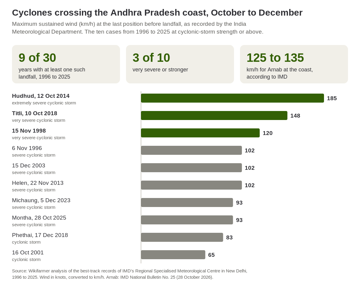
Source: Wikifarmer analysis of IMD RSMC New Delhi best-track records, 1996 to 2025. Arnab: IMD National Bulletin No. 25 (28 October 2026).
ECMWF forecasts 247 mm of rain near Kakinada on 2 to 4 November
In the forecast of the European Centre for Medium-Range Weather Forecasts (ECMWF) issued at 00:00 UTC on 29 October, the grid point at 16.75°N 82.25°E, near Kakinada, accumulates 247.3 mm of rain from 2 to 4 November, with 123.0 mm on 3 November, and 268.6 mm over ten days, to 7 November. The previous day's run gave 128.7 mm for the same three days, so the forecast changed a great deal in 24 hours, and it describes a single 0.25-degree grid point. In National Bulletin No. 32, IMD is watching a low-pressure area over the south Andaman Sea that is very likely to become well marked in the next 24 hours and likely to concentrate into a depression over the southeast Bay of Bengal in the 24 hours after that. IMD expects it to move west-northwestwards but does not say whether or where it will reach the coast.
For producers in the delta, the coming weeks coincide with the start of ripening and harvest, so field drainage, lodging in rice and IMD's bulletins on the new low are the information of direct use. For rice buyers, the first official picture will come from the state's final assessment and from the central assessment teams that, according to Deccan Chronicle, the Chief Minister has requested, and one region is only one of the factors behind India's national rice output.
Frequently asked questions
When and where did Cyclone Arnab make landfall?
According to IMD, Arnab crossed the Andhra Pradesh and Yanam coasts between 02:00 and 08:00 India time on 28 October 2026, near 16.45°N 81.9°E, about 20 km east-northeast of Narsapur.
How strong was Arnab?
IMD classed it as a very severe cyclonic storm at landfall, with maximum sustained winds of 125 to 135 km/h gusting to 150 km/h. By 08:30 it had weakened into a severe cyclonic storm.
Is there an official estimate of rice damage?
As of 29 October there are only the state's preliminary estimates, as reported by the press. The Agriculture Minister presented 224,489 hectares of crops in 14 districts, and according to The Pioneer and TeluguPeople about 209,460 hectares of these are paddy.
Will it rain again on the Andhra Pradesh coast?
ECMWF's forecast of 29 October gives 247.3 mm of rain on 2 to 4 November at the grid point near Kakinada, and IMD is watching a new low-pressure area over the Andaman Sea. The forecast changes from run to run, so producers need IMD's latest bulletins.
How often do such cyclones hit Andhra Pradesh?
From 1996 to 2025, cyclones of cyclonic-storm strength or above crossed the state's coast in October to December in 9 of 30 years, and three were very severe or stronger, in 1998, 2014 and 2018.
What stage is rice at in southern India?
In GEOGLAM's calendar for southern India, kharif rice completes its vegetative to reproductive phase on 31 October, ripening and harvest run from 1 November to 14 December, and the end of the harvest season to 14 January.
Important notes
The position, timing and intensity of Arnab, the recorded rain and the expected impacts come from IMD National Bulletin No. 25 and IMD's press release of 28 October 2026, and the system's later track and the new low from National Bulletin No. 32 of 29 October. Wikifarmer counted past cyclones in the RSMC New Delhi best tracks, using IMD's landfall remarks that place the crossing on the Andhra Pradesh coast between 13.5°N and 19.1°N, with at least 34 knots at the last position before the remark. Phailin (2013), which crossed near Gopalpur in Odisha, and Mandous (2022), which crossed in Tamil Nadu, are therefore not counted. The count starts in 1996 because the file does not give complete landfall remarks for earlier years. The chart's wind speeds are converted from knots and are not directly comparable with the bulletin's figures for Arnab. The affected-area figures and the deaths come from the press, not from an official document. The forecasts are ECMWF's runs of 28 and 29 October, and the totals were computed from the model's accumulated rain. The article does not estimate production losses or price effects.
Sources
- India Meteorological Department. (2026, 28 October). National Bulletin No. 25 (BOB/08/2026), Severe Cyclonic Storm "Arnab" over Coastal Andhra Pradesh & Yanam.
- India Meteorological Department. (2026, 28 October). Press Release, 13:45 IST.
- India Meteorological Department. (2026, 29 October). National Bulletin No. 32 (BOB/08/2026), Depression (remnant of VSCS "Arnab") over south Chhattisgarh and adjoining south Odisha.
- India Meteorological Department, RSMC New Delhi. Best track data of tropical cyclonic disturbances over the north Indian Ocean, accessed 27 October 2026.
- GEOGLAM Crop Monitor. AMIS crop calendars, accessed 23 October 2026.
- European Centre for Medium-Range Weather Forecasts. Open data, IFS 0.25°, runs of 28 and 29 October 2026, 00:00 UTC.
- Deccan Chronicle. (2026, 28 October). Naidu seeks central teams to assess Arnab cyclone damage.
- The Pioneer. (2026, 29 October). Cyclone Arnab live: storm weakens to deep depression, Andhra counts 2.24 lakh hectares of crop loss.
- TeluguPeople. (2026, 29 October). Cyclone Arnab damages crops across 2.24 lakh hectares in AP.
- Telugu360. (2026, 28 October). Cyclone Arnab: Naidu seeks central aid as crops across 81,350 hectares are hit.