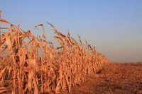

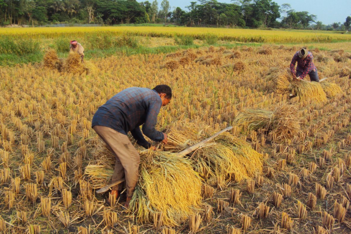
A low-pressure area formed over the south-east Bay of Bengal at 05:30 India time on 13 November 2026, and the India Meteorological Department (IMD) says it is likely to become a cyclonic storm over the central Bay on the evening of 16 November. IMD has not yet given a landfall area, but in the review of numerical models it published the same day most models steer the system west-north-west, towards the coast of Andhra Pradesh in south-eastern India, with landfall around 19 to 20 November. Along that coast the monsoon-season (kharif) rice crop is in ripening and harvest according to the GEOGLAM crop calendar, and the state has already taken two cyclones in 2026, Arnab on 28 October and Murasu on 3 November.
IMD expects a cyclonic storm over the central Bay of Bengal on the evening of 16 November
In the Tropical Weather Outlook issued by IMD's regional centre in New Delhi at 06:00 UTC on 13 November, the low-pressure area formed at 00:00 UTC under the influence of an upper-air cyclonic circulation over the central Andaman Sea. IMD says it is very likely to move north-west, become a well-marked low on 14 November and a depression over the same region around the morning of 15 November, and that it is then likely to move north-north-west and intensify into a cyclonic storm over the central Bay of Bengal around the evening of 16 November. The outlook's table gives a nil probability of a depression forming in the first 24 hours, moderate for 24 to 48 hours and high, meaning 67% to 100%, for 48 to 72 hours. The US Joint Typhoon Warning Center (JTWC) tracks the same system as Invest 92B, near 8.3°N 87.6°E and moving north-west, in its advisory of 00:00 UTC on 13 November.
Most models steer the system towards the Andhra Pradesh coast
IMD's Tropical Cyclone Forecast Programme report of 13 November, issued at 10:00 UTC, sets out what each numerical model shows, and the model tracks in it are guidance for forecasters, not IMD's forecast. According to the report's summary, ECMWF, the US NCEP-GFS, ECMWF's artificial intelligence model (EC-AIFS), AIGFS and IMD models move the system west-north-west towards the Andhra Pradesh coast, intensifying into a deep depression or cyclonic storm during 17 to 19 November, with large differences in intensity and landfall point. ECMWF brings it ashore on the north Andhra Pradesh coast as a severe cyclonic storm around 12:00 UTC on 19 November, near 16.7°N 82.4°E, NCEP-GFS as a deep depression around 18:00 UTC the same day, near 16.5°N 81.9°E, and AIGFS as a cyclonic storm at 06:00 UTC on 20 November, near 18.4°N 84.2°E, while EC-AIFS takes it further south, to the south Andhra Pradesh coast, as a deep depression around 06:00 UTC on 19 November, near 13.7°N 80.4°E. The MITHUNA, NEPS, IMD AURORA and IMD FGN models also move it towards the north Andhra Pradesh coast, but weaken it before landfall. IMD's own GFS and GEFS send it towards south Myanmar and the north Andaman Sea, and according to the summary IMD FCN and NCMRWF's GraphCast and Pangu models move it north-north-east, towards the coasts of Bangladesh and Myanmar. The report concludes that there is reasonable consensus on formation and west-north-west movement, but considerable divergence on the track, intensity and landfall.
ECMWF's forecast concentrates the rain around Kakinada on 18 to 20 November
In the 00:00 UTC run of 13 November from the European Centre for Medium-Range Weather Forecasts (ECMWF), rain from 18 to 20 November reaches 193.8 mm at the grid point south of Kakinada, in the Godavari river delta, of which 189.0 mm falls on 19 November, while up to 17 November the same point stays almost dry. Near Kakinada the forecast gives 180.9 mm and near Visakhapatnam 178.2 mm, in south Odisha Gopalpur has 109.6 mm and at the northern end of Andhra Pradesh Srikakulam has 79.1 mm, while further south, at Narsapur, Machilipatnam, Bapatla and Ongole, where Arnab and Murasu came ashore, the values stay below 27 mm. The highest value in the zone from 15° to 20°N and 80° to 86°E is 352.1 mm at 17.00°N 82.50°E, at sea off Kakinada, and 20 of the zone's 525 grid points exceed 200 mm, according to a Wikifarmer analysis of ECMWF open data. The picture changes from run to run, since the 12 November run put most of the rain in south Odisha.
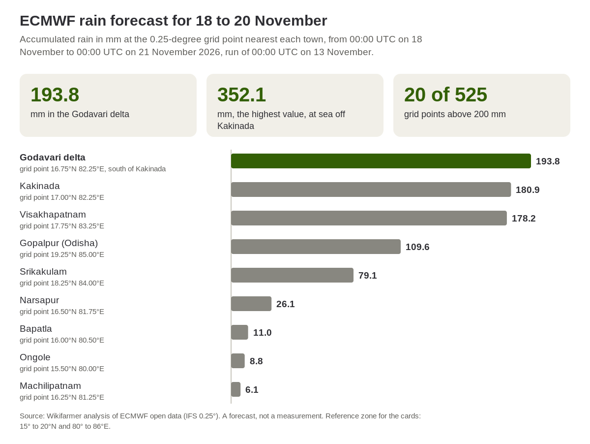
Source: Wikifarmer analysis of ECMWF open data (IFS 0.25°), run of 00:00 UTC on 13 November 2026, rain from 00:00 UTC on 18 November to 00:00 UTC on 21 November. A forecast, not a measurement.
Kharif rice is in ripening and harvest according to the GEOGLAM calendar
In the GEOGLAM crop calendar for southern India, the ripening and harvest of kharif rice run from 1 November to 14 December, while for eastern India the same calendar puts ripening and harvest from 1 October to 30 November. The landfall dates in the models, 19 and 20 November, therefore fall within the harvest period in both zones. GEOGLAM does not give the zone boundaries in the file examined, so it cannot be confirmed that the north coastal districts of Andhra Pradesh belong to its southern zone or that south Odisha belongs to the eastern one.
Two cyclones have already crossed the Andhra Pradesh coast in 2026
In 2026 Andhra Pradesh took Arnab, which crossed the coast near Narsapur on 28 October as a very severe cyclonic storm, and six days later Murasu, which came ashore near Ongole on 3 November as a severe cyclonic storm, according to IMD press releases. In IMD's best-track records from 1996 to 2025, 10 cyclones of cyclonic storm strength or above crossed the state's coast between October and December, in 9 of the 30 years, and the only year with two landfalls was 2018, according to a Wikifarmer analysis. If the new system crosses Andhra Pradesh at cyclonic storm strength, 2026 will be the first year in the records with three such cyclones on the state's coast in one season. After Arnab, the state's agriculture minister presented preliminary estimates of crop damage on 224,489 hectares in 14 districts, according to press reports on 29 October.
IMD bulletins will give the landfall area and the advice for crops
Once the depression forms, IMD issues national bulletins with the track and district warnings, and these will show whether the system heads for the coast of Andhra Pradesh, Odisha or Bangladesh. In IMD's press release of 3 November for Murasu, the agrometeorological advice for the coastal districts asked for drainage in rice and other fields and for farmers to lift lodged plants once the rain stopped, and for Telangana it advised postponing the harvest of mature rice and moving harvested produce to a safe place. For rice buyers, the first picture of crop damage is expected from the state government's estimates after landfall, which after Arnab became known through the press. Andhra Pradesh is one of several rice-producing states in India, so damage in one area is only one factor in national output, and the picture will change if the bulletins of the coming days move the track towards Odisha or Bangladesh.
Frequently asked questions
When is the Bay of Bengal system expected to become a cyclone?
According to IMD's Tropical Weather Outlook of 13 November, the low-pressure area is very likely to become a depression around the morning of 15 November and is likely to intensify into a cyclonic storm over the central Bay of Bengal around the evening of 16 November.
Where will it make landfall?
IMD has not yet given a landfall area. In IMD's model review of 13 November most models point to the Andhra Pradesh coast on 19 to 20 November, some of them weakening the system before landfall, while others point to Bangladesh and Myanmar.
How much rain do the forecasts show?
ECMWF's 00:00 UTC run of 13 November gives 193.8 mm from 18 to 20 November in the Godavari delta, south of Kakinada, and 178.2 mm near Visakhapatnam. This is one model's forecast for grid points and it changes from run to run.
Which crops are exposed?
According to the GEOGLAM calendar, kharif rice is in ripening and harvest in southern and eastern India. In its advice for Murasu, IMD asked Telangana farmers to postpone the harvest of mature rice and move harvested produce to a safe place, and asked for drainage in coastal fields of rice, groundnut, cotton, sugarcane, maize, vegetables, banana and papaya.
How many cyclones have crossed Andhra Pradesh this year?
Two, Arnab on 28 October and Murasu on 3 November. In IMD's records from 1996 to 2025, no year had more than two cyclones crossing the state's coast between October and December.
Important notes
The article is based on forecasts and will be updated when IMD gives a landfall area. The system's development and the probabilities come from IMD's Tropical Weather Outlook of 06:00 UTC on 13 November, and the model tracks from IMD's Tropical Cyclone Forecast Programme report of 10:00 UTC the same day, where the model tracks are guidance and not IMD's forecast. The JTWC position comes from its ABIO10 advisory of 00:00 UTC on 13 November. India time is UTC plus 5.5 hours. ECMWF rain values refer to the 0.25-degree grid point nearest each town, from 00:00 UTC on 18 November to 00:00 UTC on 21 November, and were calculated by Wikifarmer from ECMWF open data. The count of past cyclones was made by Wikifarmer in the best-track records of RSMC New Delhi from 1996 to 2025, with the same method used for Arnab and Murasu, and 2026 is not yet included in them. The damaged areas after Arnab come from the press, not from an official document. The article does not estimate production losses or price effects.
Sources
- India Meteorological Department, RSMC New Delhi. (2026, 13 November). Tropical Weather Outlook for the north Indian Ocean, issued at 0600 UTC, retrieved 13 November 2026.
- India Meteorological Department, Cyclone Warning Division. (2026, 13 November). Tropical Cyclone Forecast Programme report, 1000 UTC, retrieved 13 November 2026.
- Joint Typhoon Warning Center. (2026, 13 November). Significant tropical weather advisory for the Indian Ocean, ABIO10 PGTW 130000.
- European Centre for Medium-Range Weather Forecasts. Open data, IFS 0.25°, run of 00:00 UTC on 13 November 2026.
- GEOGLAM Crop Monitor. AMIS crop calendars, retrieved 23 October 2026.
- India Meteorological Department, RSMC New Delhi. Best track data of tropical cyclonic disturbances over the north Indian Ocean, retrieved 27 October 2026.
- India Meteorological Department. (2026, 28 October). Press Release, 13:45 IST.
- India Meteorological Department. (2026, 3 November). Press Release, 13:30 IST.
- TeluguPeople. (2026, 29 October). Cyclone Arnab damages crops across 2.24 lakh hectares in AP.