
Can the sky warn a farmer before the rain arrives? It can, but only if the farmer knows how to read it. Changes in cloud height and vertical growth can signal an approaching front or storm, and farmers have long relied on signs like these, as the traditional indicators still used in Guatemala show. Read together with a pressure chart for the coming days, the clouds become a practical tool for deciding when to spray, cut or harvest.
A single cloud will not tell you whether it will rain in an hour. What matters is the pattern, so look at the sky twice, fifteen to thirty minutes apart. Between the two observations, note whether the clouds have changed in height, shape, colour or direction of movement, and whether they are growing upwards or spreading sideways. Knowing a cloud's name is one thing. Recognising how it is changing is what lets you anticipate the weather, and that starts with the main cloud groups.
Reading clouds from high to low
The World Meteorological Organization's International Cloud Atlas recognises ten main cloud types. There is no need to memorise all ten to make decisions on the farm. Two questions do most of the work. How high does the cloud appear to be, and is it spreading horizontally or growing vertically?
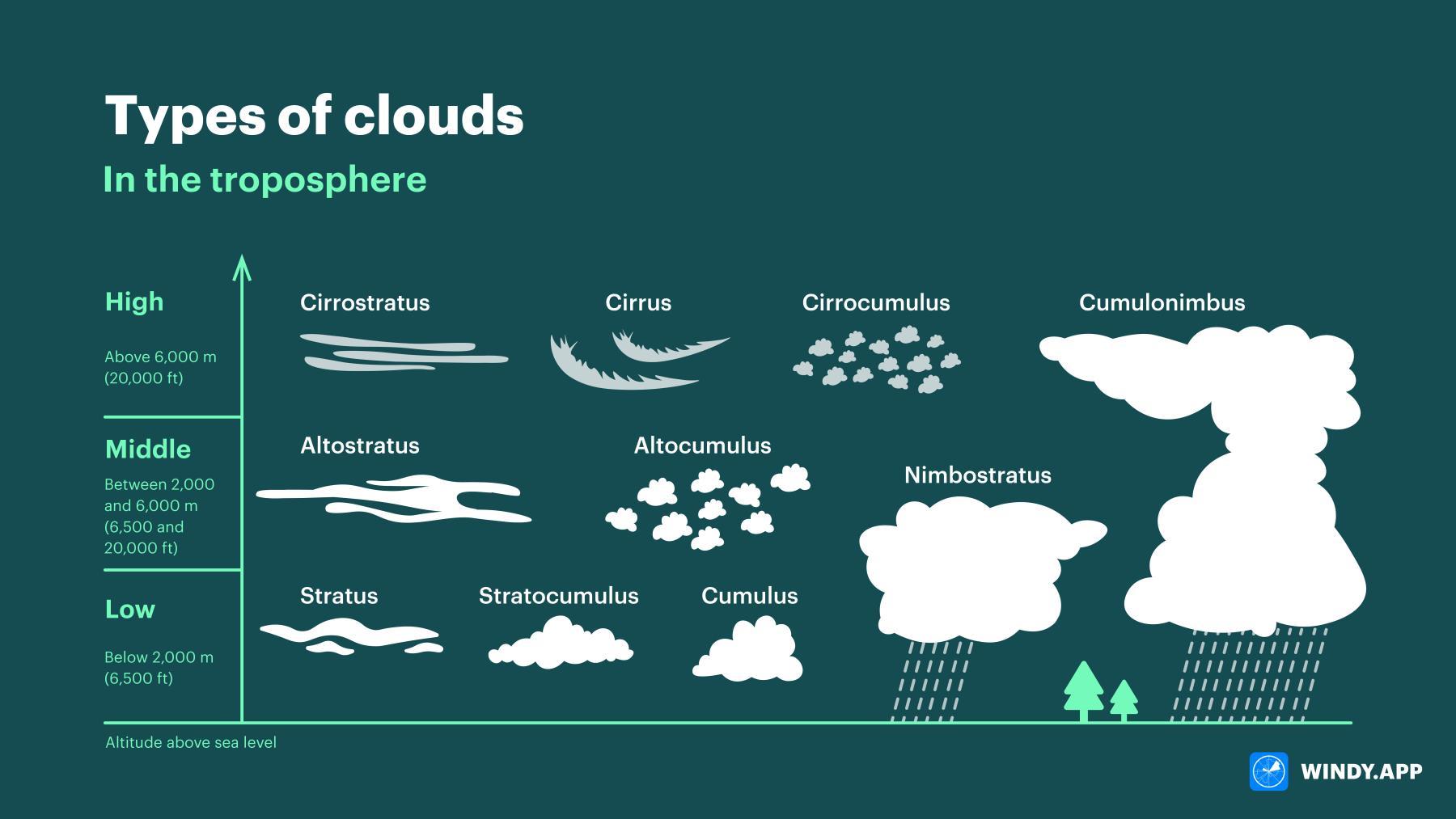
The ten main cloud types by height. Heights are approximate and vary with latitude. Source: Windy.app.
High clouds
Cirrus clouds are high, thin and fibrous. Isolated cirrus rarely means rain. When they multiply and gradually spread across the sky, though, they can be the first visible sign of a change in the weather, usually within a day or so rather than within hours.
Cirrocumulus appears as many very small cloudlets, sometimes described as a mackerel sky, and usually brings no rain at all.
Cirrostratus forms a thin, whitish veil through which the sun or moon stays visible, often with a halo around it. If that veil gradually thickens, rain becomes more likely over the following 12 to 24 hours.
Middle clouds
Altocumulus usually appears as large white or grey patches, rolls or rounded clumps, and most of it produces little or no rain. If it starts to develop small towers growing upwards, especially in the morning, showers or thunderstorms may follow later in the day.
Altostratus is a more uniform grey layer. The sun may still show through it, but noticeably weaker than through cirrostratus. If the layer becomes thicker, darker and lower, a period of widespread rain lasting several hours to a day may be only a few hours away.
Low clouds
Stratus is a low, uniform grey layer that looks like fog lifted off the ground. It can bring mist or drizzle, but rarely heavy rain.
Stratocumulus has a more lumpy, rounded appearance and usually means dry weather or, at most, light rain.
Nimbostratus is darker, thicker and more extensive, with no obvious shape. It hides the sun and brings rain or snow over a wide area.
Clouds that grow upwards
Cumulus clouds have a flat base and rounded, cauliflower-like tops. Separate cumulus clouds generally go with fair weather, but a cumulus that keeps growing upwards can develop into a cumulonimbus.
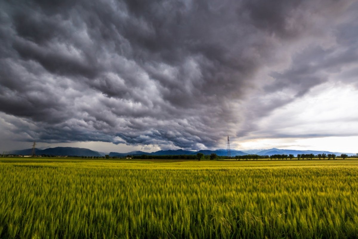
Cumulonimbus can reach from the lower to the upper sky, with a dark base and a large anvil-shaped top, and it can bring heavy rain, lightning and strong gusts. Imagine a farmer planning to spray in the afternoon. If small cumulus clouds become noticeably taller and darker within thirty minutes, it is time to check the latest forecast and warnings before starting, because a shower or a strong gust may be on its way.
| Cloud | What it looks like | Change to watch for | What it usually means for rain |
| Cirrus (Ci) | Thin white feathers or fibres | Increasing and spreading across the sky | No rain directly, but a possible change in the weather within a day or so |
| Cirrocumulus (Cc) | Small white ripples or grains | Expanding | Usually no rain |
| Cirrostratus (Cs) | Thin whitish veil, sometimes with a halo | Thickening and appearing lower | Rain possible within 12 to 24 hours |
| Altocumulus (Ac) | White or grey patches, rolls or rounded clumps | Small towers developing, especially in the morning | Usually dry, but towers can mean afternoon or evening showers or thunderstorms |
| Altostratus (As) | Uniform grey layer, sun as a weak disc | Thickening and lowering | Light rain possible, steady rain within a few hours if it turns into nimbostratus |
| Nimbostratus (Ns) | Thick, dark, featureless layer covering the sky | Staying in place | Light to moderate rain or snow already falling or imminent, often for several hours |
| Stratus (St) | Low, uniform grey layer like lifted fog | Lowering or thickening | Drizzle |
| Stratocumulus (Sc) | Low rounded masses | Gaps closing and layer thickening | Usually dry, occasional drizzle or a light shower, with no reliable warning time |
| Cumulus (Cu) | Flat base with rounded cauliflower tops | Rapid upward growth and a darkening base | Local showers within tens of minutes to a few hours, lasting from half an hour to several hours if growth continues |
| Cumulonimbus (Cb) | Large dark tower, often with an anvil top | Rapid growth, dark base, spreading anvil | Heavy rain, hail, lightning and strong wind within minutes, sometimes brief and sometimes for hours |
How terrain shapes local cloud patterns
Clouds respond to the ground beneath them, and mountains have a particularly strong effect. When moist air is forced up over a mountain it cools, producing clouds and rain on the windward slope, while on the leeward side the air becomes warmer and drier, often leaving a rain shadow. Smooth, lens-shaped clouds can also form over and around mountains. They signal strong winds aloft, but not necessarily rain.
A farm on the windward side of a mountain can therefore see clouds building and receive rain while a farm a few kilometres away on the leeward side stays dry. In mountainous areas, local experience of how the weather behaves with each wind direction is especially valuable.
Large lakes and seas affect clouds too, by supplying moisture and creating temperature differences. Sea and lake breezes can push moist air inland and help clouds or thunderstorms form where air streams meet, and cold air moving over relatively warm water can produce bands of cumulus and showers downwind. Read these local signals together with the wind direction and the wider forecast.
Cloud sequences and weather fronts
Individual cloud types are useful, but the order in which they appear can reveal an approaching weather front, the boundary between two air masses. As air rises along that boundary, characteristic clouds and weather develop. The cloud sequence shows how the weather is changing overhead, and a surface pressure chart explains the larger system behind it.
A typical case is a farmer making hay while thin cirrus gradually spreads across the sky. If a halo appears later and the cloud becomes thicker and lower, a warm front may bring persistent rain within 12 to 24 hours, which may be the last chance to finish the hay and get it covered.
| Front | Cloud sequence | Likely weather | Timescale | What it means on the farm |
| Warm | Cirrus, then cirrostratus, altostratus and nimbostratus | Gradually increasing, widespread rain | Usually 12 to 24 hours as the sequence develops | Finish spraying, harvesting or haymaking before the persistent rain |
| Cold | Growing cumulus, then cumulonimbus | Sudden heavy showers, gusts and thunderstorms | Several hours, sometimes minutes once a shelf cloud approaches | Stop spraying and exposed fieldwork, and protect workers and livestock |
| Occluded | Altostratus or nimbostratus, sometimes cumulonimbus | Widespread rain and possibly strong wind | Several hours to a day | Prepare for a long wet or windy spell |
| Stationary | Persistent stratus, altostratus or nimbostratus | Repeated or prolonged rain over the same area | One or more days | Watch drainage, field access and crop disease risk |
Reading pressure charts for the days ahead
Cloud observations show what is happening directly above the farm, while a surface pressure chart shows the wider weather system. High-pressure areas are marked H. Air usually sinks in them, which tends to bring calmer, drier and more stable weather, although high pressure can also trap fog, low stratus, heat or drought for several days.
Low-pressure areas are marked L. Air rises in them, cools and forms cloud more easily, making rain, stronger winds and unsettled weather more likely, especially near fronts. The curved lines around highs and lows are isobars, joining places with equal air pressure. Where isobars are close together, pressure changes quickly over a short distance and winds are usually stronger, which matters when deciding whether conditions suit spraying, harvesting or working safely in exposed fields.
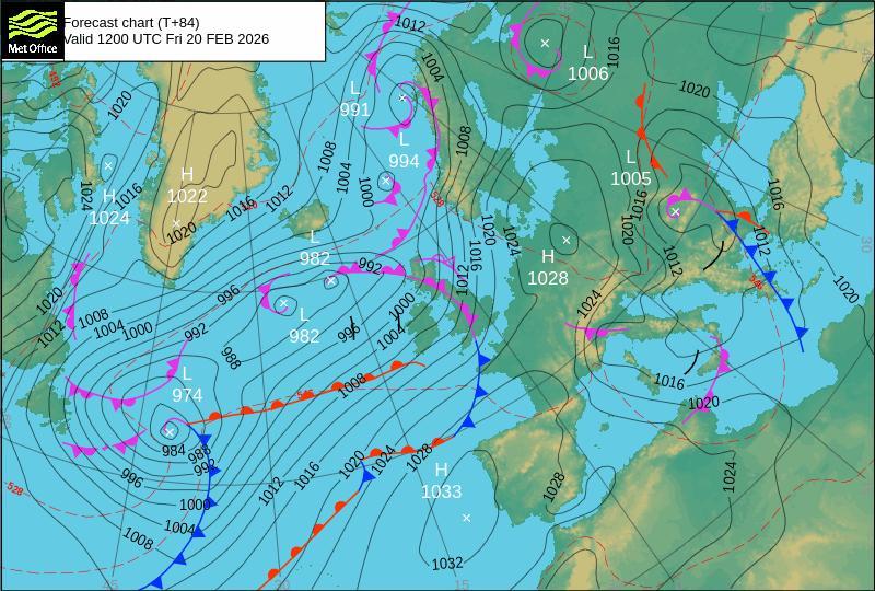
A surface pressure forecast chart. Source: Met Office. Contains public sector information licensed under the Open Government Licence v3.0.
Fronts are drawn with standard symbols. As the Met Office explains in its guide to synoptic charts, warm fronts are red lines with semicircles and cold fronts are blue lines with triangles, and the symbols point in the direction the front is moving.
To use a chart, first find your farm and then look for the nearest H, L and fronts. Then compare the current chart with the forecast charts for the next 24, 48 and 72 hours. If a low or a rain-bearing front is moving closer and the isobars are tightening, wet and windy weather is becoming more likely. Five-day charts can suggest a possible dry or wet window, but confidence falls after the third day. A single H or L on today's chart does not predict the next five days by itself, because what matters is how the system is moving.
Suppose today's chart shows high pressure and good harvesting conditions, while the 48-hour chart shows a low and a front heading towards the farm. The farmer can use the remaining dry spell to harvest, and hold off irrigating if substantial rain is expected.
The chart is most useful alongside what you see outside. Thickening cloud, a lowering cloud base and an approaching low together are stronger evidence of rain than any one of them alone, and that combination helps with planning spraying, irrigation, harvesting, field access and livestock protection. Check official forecasts and warnings before any important decision.
From observation to decision
Clouds give local clues, while fronts and pressure charts show the wider system. By combining repeated sky observations with an official forecast chart, farmers can recognise approaching rain earlier and make better-informed decisions. These methods support professional forecasts and warnings, and do not replace them.